Concern for the environment has been steadily
increasing for the past several decades. This awareness has led to increased
efforts to clean up past problems and to reduce the future impact on the environment.
Geophysics has a role to play in both areas.
Environmental geophysics is a relatively
new field. It is primarily used to identify, map or predict the presence
and potential movement of surface water
and groundwater and to identify contaminants in the soil within the upper
10 to 50 m of the Earth's surface. It can also be used to help locate sites
for
underground waste disposal, examine archaeological sites or even assist the
police in their investigations of possible burial sites.
Working Conditions
Environmental geophysicists often are part of multi-disciplinary teams which include geological engineers, biologists, hydrogeologists and technicians. They can be involved in a wide variety of activities that are both geophysically and non-geophysically related.
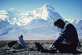
Environmental geophysicists often welcome the chance to leave the desk behind, pack up their portable computer and travel out of the city to investigate problem sites, even in inclement weather. In addition to doing field work in the rural environment, some field work is done in urban settings. As flexible people, they become involved in water or soil sampling, mapping and statistics as well as conducting their own geophysical surveys.
Data Collection
Environmental geophysicists use many of the instruments and techniques used in mining and petroleum geophysics such as magnetic, electrical and seismic methods. Adapted for use at shallow depths, these methods are very effective.
Seismic surveys, redesigned for shallow targets, are less common due to their higher cost but in some situations, their usefulness outweighs the extra dollars needed.
Ground Penetrating Radar
A relatively new technique, ground penetrating radar (G.P.R.), is being tested. As the name suggests, it puts a very high frequency radio signal into the ground and records the reflected signal much like the seismic method.


