For over 50 years, Canada has led the world in the field of geophysical exploration
for minerals. This prominence is natural because Canada has a large land mass
and has one of the highest potentials for the discovery of mineral resources.
Copper, lead, zinc, iron, gold and potash are among these resources. The discovery
of diamonds in the Canadian Arctic, (NWT and Nunavut, Northern Alberta, Quebec)
has lead to further exploration, mining and manufacture of distinctly Canadian
diamonds.
Working Conditions
Like petroleum geophysicists, mining geophysicists often work in teams which include geologists, engineers and support technicians. These teams plan the work, collect and interpret field data, and evaluate the economic potential of their findings.
While some of their work is done in the office, mining geophysicists will
often spend time working in remote areas and living in bush camps. For the
lover of outdoor activities, this is one of the most rewarding parts of the
profession.
Data Collection
Many minerals are found because they have unique geophysical characteristics detectable by sensitive instruments. Collecting precise data is one of the most important parts of the job and may require many weeks or months of field work.
Mining geophysicists use many different instruments to help them locate minerals. For reconnaissance work, instruments such as airborne magnetometers, various electromagnetic sensors and radioactivity detectors are flown from planes.
Detailed work is generally done with ground-based instruments, measuring the
same properties as airborne instruments plus several others. One of these is
Induced Potential (I.P.) where geophysicists put electrical pulses into the
ground and then measure the decay of voltage. They look for variations in the
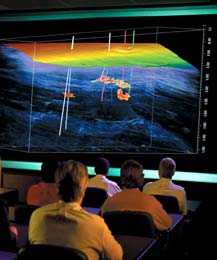
rate of decay to find mineral deposits. Recent work with three-dimensional
I.P. surveys has produced some of the sharpest images ever created in mining
exploration.
Mining geophysicists also use the seismic method, borrowed from the petroleum geophysicist, for coal and potash exploration. The seismic method has value in detecting breaks in these deposits to help determine the extent of the mineral. It can even 'see' the mine workings.
Mining and petroleum geophysicists are also working together in the experimental use of the seismic method for identifying sulphides of iron and copper.