Abstract
Electromagnetic methods have a transmitter that carries a current that varies in magnitude as a function of time. This current has an associated (primary) magnetic field that has a similar time dependence. According to Faraday's law of induction, this time varying field induces currents in conductive features in the ground. These currents have an associated (secondary) magnetic field that can be detected by an electromagnetic receiver. There is no need for the transmitter or the receiver to touch the ground, so electromagnetic systems can be mounted on aircraft and used to cover large areas quickly and efficiently.
In time domain EM systems, the time variation of the current is a switch on, followed by a rapid switch off. In general, good conductors have secondary field responses which decay slowly after the switch off. One example from the Shea Creek area of the Athabasca Basin (northern Saskatchewan) shows that these good conductors can be detected at depths as great as 700m when the conductor is large and the intervening material is highly resistive. Poor conductors have responses that decay away rapidly. The alteration above the Millennium deposit (also in the Athabasca Basin) is an example of a response that decays away in about 300 microseconds. Historically, airborne electromagnetic methods have been most successful for massive sulphide exploration in Manitoba, Ontario, Quebec, New Brunswick and Newfoundland and Labrador.
In sedimentary basins, the decay of the electromagnetic response can be used to infer the conductivity as a function of depth. The shallower part of the section is inferred from the early time data and the late time data is used to estimate the deeper parts of the section. When the ground is about 10 Ohm•m, airborne electromagnetic systems can only see about 300 m deep. Hence they cannot see most hydrocarbon deposits. However, electromagnetic methods have been a useful compliment to high resolution seismic in the search for shallow gas in some of the paleochannels in Alberta.
Electromagnetic methods are being utilized in the search for fresh water. In one example from Denmark, the method has been used to successfully map the thickness of a freshwater aquifer. Using airborne methods, an area of more than 100 km2 was covered in a few days surveying, where it would have taken months to cover the same area using ground methods.
Biography
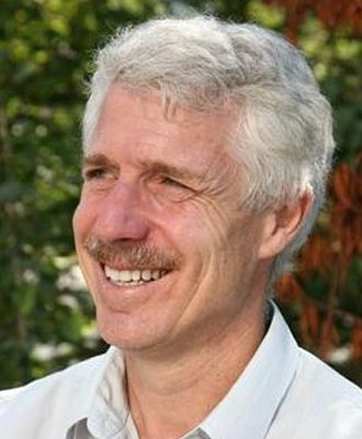
Richard Smith received a first-class honours degree in Economic Geology from the University of Adelaide, Australia. He has Masters degrees from the University of Adelaide and the University of Toronto and a PhD in Physics from the University of Toronto (where he was supervised by Gordon West). His graduate work involved electromagnetic modeling and explaining the unusual negative transients observed by exploration companies in their electromagnetic data.
After graduation, Dr. Smith worked for Lamontagne Geophysics in Toronto, where he helped extend the concept of conductivity depth imaging to airborne electromagnetic data. He then held a post-doctoral fellowship at Macquarie University in Australia.
Richard Smith has worked in the Australian mineral exploration industry for Pasminco Ltd. as part of a team exploring for lead and zinc deposits. He primarily worked at Broken Hill in New South Wales and Roseberry in Tasmania, but also had exposure to exploration plays in other parts of Australia and the world.
In 1993, Richard joined Geoterrex Ltd, an airborne geophysical survey company, where he worked as a research scientist in ground and airborne geophysics. There he helped develop methods for acquiring and interpreting geophysical data. He co-developed the capability to collect B-field data rather that dB/dt data (the former is more sensitive to highly conductive bodies). With Jeff Thurston and others, he developed the Source Parameter Imaging (SPI) method, which uses the local wavenumber of magnetic data to estimate the depth to the magnetic sources. He has also published a number of case histories of geophysical methods being used for mineral and oil exploration. From 2000 to 2009 he was the R&D Manager at Fugro Airborne Surveys in Ottawa.
In May 2009, Richard took up an Industrial Research Chair in Exploration Geophysics at Laurentian University in Sudbury. There he will be working with sponsor companies on developing tools to acquire, process and interpret geophysical data to assist in the discovery of ore bodies in the Sudbury Basin and beyond.
Dr. Smith is active in the geophysical community participating in committees of the Society of Exploration Geophysicists (SEG), the Australian SEG and the Prospectors and Developers Association of Canada. He has taught a number of Continuing Education Courses with the SEG and is currently the Chair of the Mining and Geothermal committee of the SEG. Richard was a CSEG scholarship recipient in 1985/86 and has published two articles in the CSEG Recorder. Dr. Smith is the recipient of a number of awards for the "best presentation" at conferences and is a co-recipient for the award for the best paper in the journal Geophysics for 1997. He is recognized internationally as a leading authority in airborne electromagnetic methods and in techniques for interpreting magnetic data.


