Abstract
An Overview of 4 Decades of Permafrost Geophysics
Dr. Jim Henderson
The application of geophysics to permafrost scenarios really began to take hold in the 1970’s with the proposed Canadian Arctic Gas project. After a brief introduction to the complexities involved in using geophysical techniques to map permafrost, this presentation will document some of the ground breaking work that was done in the 1970’s and show the progression of the development of geophysical techniques since that time. Given the complexities, it is critical take an interdisciplinary approach to the interpretation of permafrost.
Electrical resistivity tomography as a tool for permafrost investigations
Dr. Teddi Herring
Permafrost thaw in the North is altering landscapes, damaging infrastructure, and even releasing greenhouse gasses. Understanding how permafrost is changing over time is a crucial and growing field of research. Electrical resistivity tomography (ERT) is a geophysical method that is increasingly being used in permafrost investigations to estimate the spatial extent of frozen regions, and repeated surveys can help to understand how permafrost conditions are changing over time. However, most ERT datasets remain unpublished, and there is no existing framework for archiving or accessing historical surveys. This presentation discusses recent efforts to standardize data processing and improve data sharing practices so that ERT data can be used to understand permafrost conditions over a large range of spatial and temporal scales.
Biography
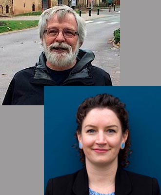
Dr. Jim Henderson has in excess of 45 years experience in geophysics. Following graduation from the University of Toronto, he joined Northern Engineering as a project geophysicist managing field programs which involved the use of state-of-the-art geophysical applications to map permafrost distribution in remote areas. Jim has played a pivotal role in pioneering the application of geophysics for surface mineable and in-situ oil sands exploration and development.
He joined Hardy Associates in 1977 as an engineering geophysicist and was responsible for the project management of a wide range of geophysical applications. In 1979 he participated in the formation of Geo-Physi-Con Co. Ltd. and was Vice-President, later promoted to President. In 1993 he joined AMCL as Manager of Geophysical Services with the special responsibility of establishing a geophysical group to service the resource sector. While at AMCL/DMT he successfully completed his M.E. Des. and PhD.
Dr. Teddi Herring is passionate about using geophysics to solve environmental problems. She completed her PhD in geophysics at the University of Calgary in 2021, where she worked to improve geophysical monitoring strategies for sites with high potential for groundwater contamination. She now works as a postdoc with NSERC PermafrostNet at the University of Ottawa, where she uses geophysics to study permafrost. Her research focuses on electrical resistivity tomography (ERT), which can be used to map permafrost distribution and detect changes over time. Teddi is currently working to improve data sharing strategies so that stakeholders can take advantage of the rich information contained in historical and recent ERT surveys of permafrost.


